Built-in tools for the field
These tools are accessible from the Capture screen toolbar during any session. They let researchers attach richer context without leaving the map view.
Site Observation
Capture a quick photo or typed note about anything on site. Stored separately from structured activity records for later qualitative analysis.
Quick CaptureIntercept Survey
Launch a structured multi-step questionnaire for a visitor you intercept on site. The response is automatically linked to recently saved activity records.
Person QuestionnaireGPS Location
Uses the device's GPS to auto-place your current position on the indoor floor plan. Requires a GPS-to-map calibration file configured per building.
Auto-LocatePOI Location
Overlay named Points of Interest on the floor plan. POIs with associated photos open an image preview — useful for contextualising key spatial features.
Points of InterestEnvironmental Audit
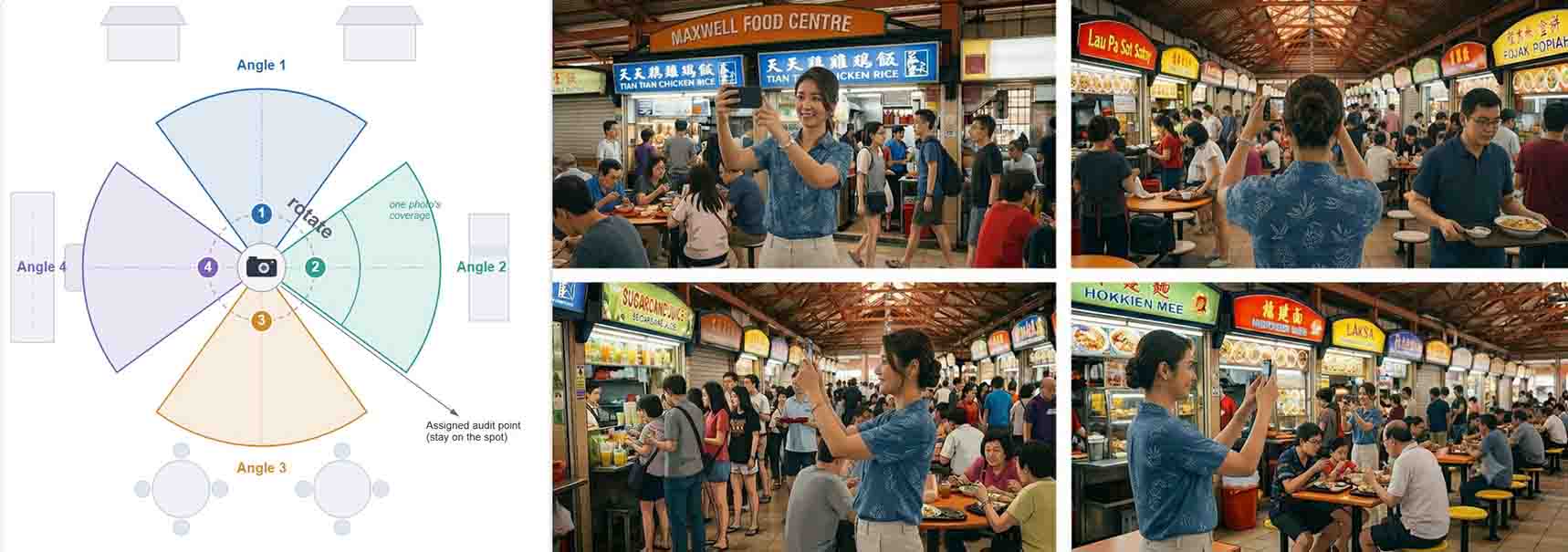
Score spatial quality attributes at any location on the floor plan. Rate dimensions such as comfort, safety, legibility, and activity support in real time.
- Auditors take photos from four angles around the audit point to capture as much of the surrounding environment as possible.
- The photos are processed with computer vision analysis to assess environmental conditions by identifying visible objects and spatial features.
Guided Observation
Follow a pre-defined route through the space with sequenced waypoints. The app guides the researcher stop by stop, prompting observations at each designated location.
- Pre-configured waypoint sequences per building
- Step-by-step navigation overlaid on the floor plan
- Observation prompts triggered at each waypoint
- Progress tracker shows completed and remaining stops